Projectwise: CDE Software for Professionals
ProjectWise is a Common Data Environment (CDE) platform that supports integrated project delivery across 4D (time), 5D (cost), 6D (sustainability), and extends into Digital Twin management for operational efficiency.

Buy ProjectWise
ProjectWise Tiers
Manage
Engineer
Validate
What’s included
About this software subscription
This Virtuoso Subscription includes a 12-month practitioner license for this software that comes with Keys(credits) to unlock training and services.
Top CDE Benefits
Key Benefits
Centralized Access & Control
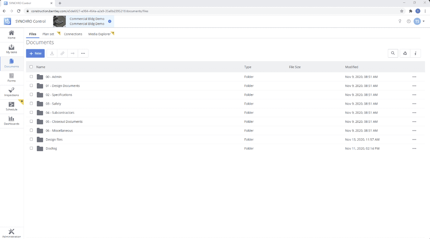
ProjectWise provides a single source of truth where all project files—PDFs, CAD drawings, and BIM models—are stored and managed. With built-in version control and access permissions, teams always work with the latest approved documents, reducing errors and rework.

Model Federation
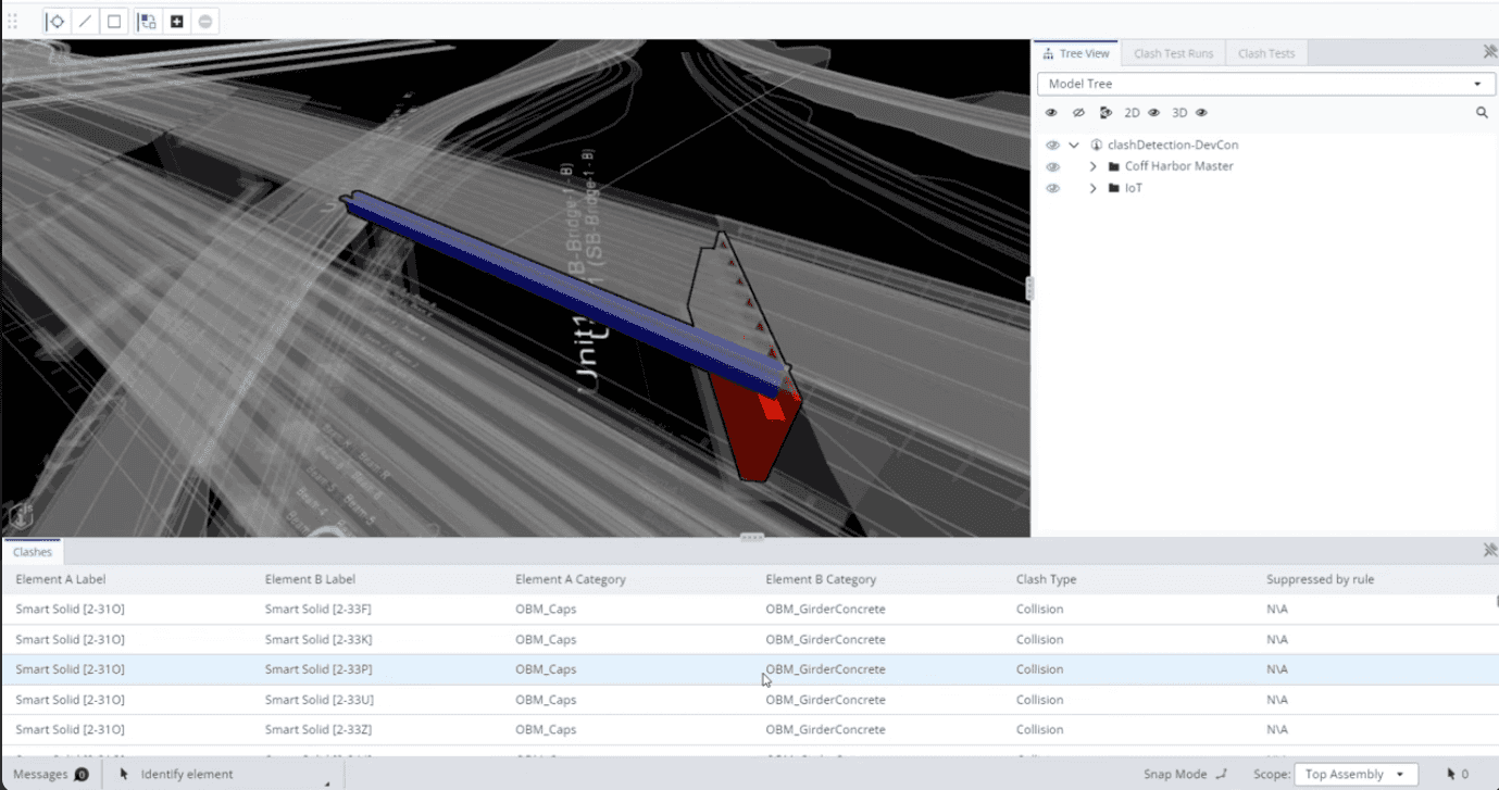
ProjectWise enables federated model views across disciplines, making it easier to detect clashes between architectural, structural, and MEP elements. Early coordination leads to fewer site issues, faster approvals, and more accurate design outcomes.

Operational Digital Twins
ProjectWise ensures all asset information is properly captured, structured, and handed over at project closeout. This data can seamlessly feed into a digital twin, enabling smarter operations and long-term asset management.

BIM CDE Features
Key Features
Centralized Document Management
Store and manage all project files, BIM models, and documents in one place with access control and version history.
Model Federation & Visualization
Combine models from different disciplines into a single view for easy coordination and web-based visualization.
Clash Detection
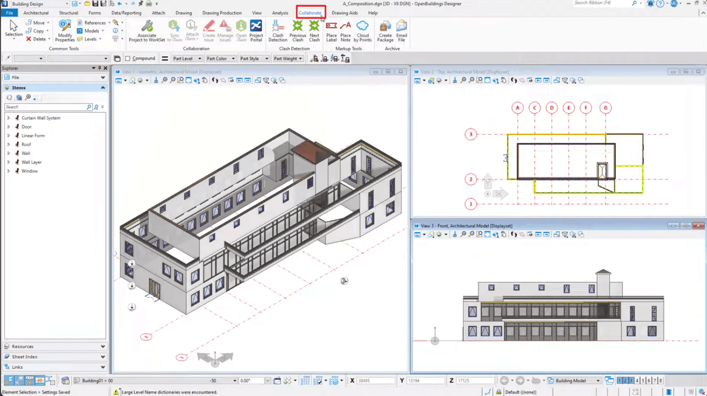
Detect and resolve clashes between architectural, structural, and MEP systems early in the design process.
Issue Tracking & Design Review
Apply markups, assign issues, and collaborate in real time to improve communication during ICE sessions.
ISO 19650 Compliance
Ensure consistent naming conventions, workflows, and approval processes in line with international BIM standards.
GIS & Survey Integration
Connect survey data and geospatial context to BIM models using drone, LiDAR, and iTwin Capture technologies.
Frequently asked questions
- What is a Common Data Environment (CDE)?
A CDE is a centralized platform for collecting, managing, and sharing all project information—documents, models, and data—across the asset lifecycle.
- How is a CDE different from Google Drive or Dropbox?
Unlike general file-sharing tools, a CDE provides BIM-specific functionality like model federation, clash detection, version control, and ISO 19650 workflows.
- Is ProjectWise ISO 19650 compliant?
Yes, ProjectWise supports ISO 19650 naming conventions, approval workflows, and metadata structures to ensure international BIM compliance.
- What file formats can ProjectWise handle?
ProjectWise supports Revit (.rvt), IFC, DWG, PDF, and many other common BIM and CAD formats via Synchronizers and iTwin plugins.
- Can I review and comment on models in a web browser?
Yes, ProjectWise provides a web-based viewer for reviewing, federating, and commenting on models without requiring desktop software. Imodels are created from BIM applications for further review on the web.
- Who should use the CDE?
ProjectWise is suitable for architects, engineers, contractors, project managers, quantity surveyors, and asset owners—anyone involved in the project delivery process.
- How is access controlled in ProjectWise?
Access can be restricted by role, folder, document, or workflow stage, ensuring users only see the data relevant to them.
- What are the licensing options for ProjectWise?
ProjectWise is offered through tiered pricing plans: Manage (SGD 396), Engineer (SGD 1507), and Validate (SGD 2816), each offering different levels of functionality.
- Does ProjectWise include training and support?
Yes, Bimeco includes onboarding, training services, and customer support as part of your ProjectWise subscription.
- Is ProjectWise a Digital Twin Solution?
ProjectWise serves as a central hub for managing engineering data and project deliverables. Digital twin workflows—such as as-built verification, sensor integration, and IoT data visualization—can be enabled through Bentley's iTwin platform, which integrates seamlessly with ProjectWise.
Professional Services
BIM Support Services
Need help implementing BIM in your project? Leverage Bimeco's professional services, advanced technology infrastructure, and tested workflows on your next project.
Our Packages